 I personally have tired out and really like the approach created by Andrew Harris, also a Melbourian by the way. You can find his approach discussed on the thread Round-tripping geocodes from Flickr to Google Maps and the actual code can be obtained from his blog “about pretty much nothing at all”. You must first save the two script from his blog article , gmap2flikrtag (which find the coordinates and writes the appropriate flickr tags) and Flickr2gmap (which will take you from a flickr photo display to the google map at the location of the photo). If you have Internet Explorer you need to select the link to these scripts and right click and select “Add favorites”, otherwise you can drag the link and drop it onto your bookmark bar on other browsers. These “favorited” links do not actually take you anywhere, like a normal bookmark would, they just run the scripts for you.
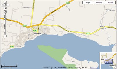
You must be in the appropriate screen to use these scripts. It is also handy to have two windows open in your browser. The first at google maps and the second open to your flickr photostream and displaying the detailed page for the photo you are tagging. By double clicking on the place you wish to locate the gmap will automatically center on that point. You will find that by selecting the area and progressively zooming the map in (you do this by moving up the slider on the little ladder on the left hand side up towards the + button) and re-centering you will be able to get very precise in your location if you desire (in Australia the “satellite” and “hybrid” options only give a “we are sorry we don’t have imagery at this zoom level” once you zoom down so you’ll have to stick on the “map” display if you want positional accuracy). You can also single click on the image and while holding the mouse button down and moving the move pan the map on the screen as another way to center the map.
 Once you have the map centered on the point you want, go to you favorites/bookmarks and select the gmap2flickrtag and once it runs you will see the coordinates written into the search box at the top of the screen. Select that and copy it. Pretty simple eh!
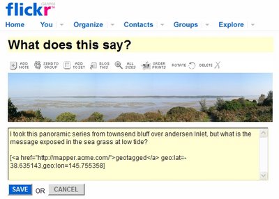
 Now switch to you flickr window and click on the add tag option and paste the corrdinates and also add the tag geotagged. That’s it! Your photo is tagged with its geospatial position and available for all the wonderful spatial search applications (like flyr)
Those using Internet Explorer 7 (its still in beta I think) may find you just get an “error in page” message when you run the scripts. You can avoid this on the gmap2flickrtag script by Disabling Script Debugging (Internet Explorer) and Disable Script Debugging (Other) found under Tools, internet options and then advanced. However at the time of writing I have not found a way to get the flickr2gmap scrip to run under IE7. The scripts run perfectly for me under IE6 & Mozilla Firefox
Finally I also use a hyper link to Jef Poskanzer’s Acme mapper as a link on my geotagged photos. Anyone viewing my flickr stream just has to click on the hyper linked underlined geotagged line and they will be automatically be transfer to a google map look alike that shows the photos location (in a similar fashion to them having their own flickr2gmap script). I also like to post in the coordinates into the comments (but this does not get recognized by the geotagging conventions to flickr, it is just for appearance)
No comments:
Post a Comment