 Full moon is tomorrow night when it is at perigee (closest to Earth)
Saturday, January 30, 2010
Thursday, January 28, 2010
Thursday, January 07, 2010
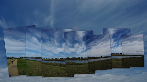
Patterson Panorama
These where part of a set of 12 photos taken from the public walkway at Patterson Lakes. What interested me most was the dramatic sky (no polarizing filter was used by the way) and thought oit would work well with the collagy/fragmented panorama effect. At first I tried hard to keep the horizon essentially level, but in the end I felt the higgledy piggledy twist & tilts added a bit of drama. This was created to be a screen wallpaper for my laptop. I used picasa, using their picture pile collage option, which now lets you slide and rotated images on the screen. I also removed almost half the images from the original series.
 Not that the more conventional autostitched panorama is not without drama. Click your mouse on the seadragon panel above and you can zoom in (with the mouse wheel or the + button) and pan around. It is a 180 degree view, and taken hand held, at approximnately 15 degree incriments, which I find give be the right sort of overlap for autostich.
Wednesday, January 06, 2010
Tuesday, January 05, 2010
Galahs Behaving Badly


The Galahs [Eolophus roseicapilla] (or maybe [Cacatua roseicapillus] there is still a controversy about there true scienitifc name) were back in greater numbers and raucously noisier. Different tree. Lots of flapping of wings and hanging upside down. I suspect they were just having fun.
Monday, January 04, 2010
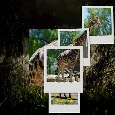
The Square Giraffe Collage

Collage of Square format images including "psuedo" polaroids. Created with Picasa.
For PhotoFriday's topic square
Sunday, January 03, 2010
A Pleasant Evening
Saturday, January 02, 2010
Chainsaw Art
Another Photosynth, this time prepared as a "walk around". This photoset was taken at mga's "materpiece in a Day" Novemeber 2009.
Sorry Mac & Linux users,Photosythn still only works for Microsoft Windows.
Friday, January 01, 2010
Not good enough. still
The geotagging ability in Flickr,  which uses Yahoo! maps, still disappoints me, almost two years on. The satellite coverage for the places I go in Australia is to put it mildly unusably imprecise. At any decent scale to recognise local features (like a major river!) in the Satellite View, you just get the message “sorry the data you have requested is unavailable”. You can get more detail from the MAP View, but where is that river?
 which uses Yahoo! maps, still disappoints me, almost two years on. The satellite coverage for the places I go in Australia is to put it mildly unusably imprecise. At any decent scale to recognise local features (like a major river!) in the Satellite View, you just get the message “sorry the data you have requested is unavailable”. You can get more detail from the MAP View, but where is that river?
I’m just grumbling because in a new year “almost resolution” way I had decided to geotag my already uploaded flickr photos. Now I just feel frustrated again and I’ve given up the idea.


